After exploring the remote island of Fair Isle, our Atlantic Odyssey voyage once more turned its attentions northwards and left the outer extremities of the UK behind. Our destination was Jan Mayen, a volcanic island situated on the mid-Atlantic ridge just north of 71° (about 550 kilometers north of Iceland and 450 kilometers east of Greenland).
Jan Mayen is reputedly shrouded in mist the vast majority of the time so it was a very pleasant surprise to see the conical crater appearing over the horizon. Over eighty nautical miles away and completely cloud free.
Brief history of Jan Mayen
Jan Mayen was recorded in early manuscripts from Norse and Irish travellers but was first occupied in the 17th century by English and Dutch whalers. It was visited infrequently till the 1900’s and then in 1906 Norwegian trappers and hunters inhabited the island seeking the blue Arctic fox for its fur.
In 1921 a meteorological station was established and since then, the island has been continually occupied. It was officially annexed to Norway in 1930 and shortly after was the only part of Norway not under German occupation, despite a number of attempts. Now, it is run by the Norwegian military and supports meteorological science year round.
Landing Båtvika, at the southern part of Jan Mayen
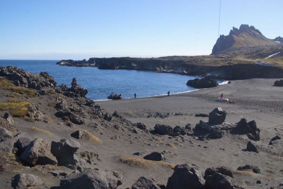
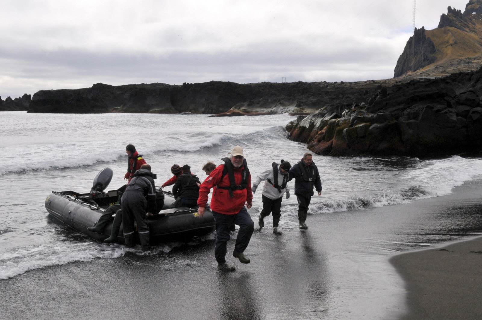
The Zodiacs left the ship and headed towards Båtvika (The Boat Cove), a bay lying on the eastern coast close to the Norwegian base. Even setting off in reasonably calm seas was no guarantee of getting ashore as even a small swell out at seas can dump large waves on the steeply sloping shoreline making for a tricky landing. We need not have worried. An idyllic cove fringed with ash black sand little troubled by the gently lapping water greeted us. Also there to greet us was an assembly of Norwegian base staff eager to welcome us onto and show off their island in the sun.
Volcanic landscape
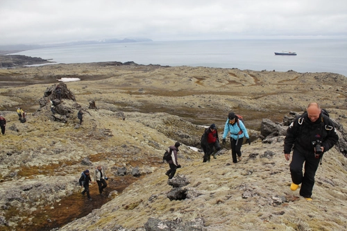
A steady stream of passengers followed our initial Zodiac disembarking with ease and steadily made their way northwards along the islands only road. Many stopped for some retail therapy at the base shop and nearly all explored the landscape beyond the base. The volcanic history of the island is evident all around and reminded me of islands in the South Shetlands. Jan Mayen can be approximated into two halves. The northern half of the island, Nørd Jan, is where Beerenburg the northernmost active volcano in the world lies. It has a classic ’Mount Fuji’ shape to it and sports a nice caldera when viewed from the satellite imagery. The southern end is no less volcanic but is a confusion of lava flows, striated hillsides and cinder cones.

The two sections are separated by a narrow isthmus of land sometimes less than 3 kilometres wide. One of the more magical experiences was when one paused and took in the volume of the kittiwake’s calls echoing from the cliffs above the road. Turning seaward, the beaches were lined with driftwood debris in the form of logs separated from their Siberian loggers and ships flotsam as well as buoys from the fishing industry.
Sailing North
After an uneventful departure, we weighed anchor and departed Jan Mayen under darkening skies with poor weather encroaching from the south. The Plancius worked its way along the spectacular coast of Nørd Jan. Stratified volcanic cliffs could be scoured through binoculars for a myriad of seabirds until our attention was diverted to a pair of humpbacks. Lovely evening light on the summit of Beerenburg dispatched us north in search of the ice.

Related Trips
Blog


Shackleton’s Push to the South Pole
Kayaking In Greenland
The Ancient Fossil Forests of Antarctica
Antarctica: When to Visit, How to Plan, What to Expect

The Eight Great Penguin Species of Antarctica
The Small but Social Commerson’s Dolphin

Wreck Diving in Antarctica
The Impact of Small vs. Large Cruise Ships

Two for the Snow: Polar Cruises for Couples
5 Misconceptions You Might Have About Greenland
9 Facts about the Greenland Shark
Ice streams and lakes under the Greenland Ice Sheet
Islands of the Blessed: Things to Do Around Cape Verde

Earth vs. Mars: Polar Regions Compared
Shackleton’s Long-Lost Endurance Discovered in Antarctica
Seven Things to Do around Ushuaia

The First Overwintering Hut in Antarctica
All things ice in the Antarctic

Traditional Lifestyles of the Inuit



 10 Days / 9 Nights
